IN Brief:
- GO Anywhere Plus is being launched for businesses in Indonesia, Singapore, Malaysia and the Philippines.
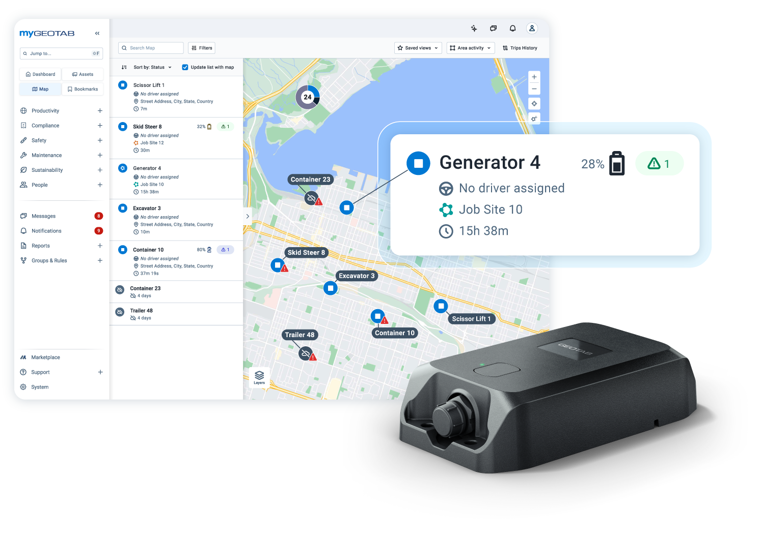
- The tracker brings trailers, containers and other equipment into the MyGeotab platform alongside fleet vehicles.
- Battery reporting modes, geofencing and equipment utilisation data support asset control, with some features dependent on installation configuration.
Geotab has introduced GO Anywhere Plus asset tracking in Indonesia, Singapore, Malaysia and the Philippines during November, extending equipment visibility beyond vehicles registered in its MyGeotab fleet management system. The regional launches cover unpowered assets such as trailers and containers, alongside generators and other industrial equipment that may move between depots, transport operators, customers and work sites.
In all four markets, Geotab is introducing the same tracker and management platform rather than separate technical products. Conventional vehicle telematics can lose sight of a trailer once the tractor is disconnected, and unpowered equipment may have no vehicle data feed at all. A dedicated tracker maintains the link between the asset identity, its last reported position and its movement history independently of a driver’s assignment.
GO Anywhere Plus can work from a wired connection or its internal replaceable battery. When connected to an asset’s electrical system, the unit can provide near-real-time movement information and, where supported, operational readings such as ignition status, distance travelled and engine hours. A battery-only installation can instead use configurable time-based or movement-based location reports, allowing operators to choose between update frequency and battery life.
Geotab quotes battery life of approximately three to five years, depending on reporting behaviour and configuration. A low-activity asset can be monitored with occasional scheduled updates, while a high-frequency mode reports at 15-minute intervals during motion. More frequent transmissions improve the timeliness of location information but consume more power, so an operator must set different reporting policies for equipment stored for long periods and equipment regularly dispatched between sites.
The hardware uses satellite navigation to establish position and cellular connectivity to report data to the platform. Manufacturer specifications identify multi-constellation GNSS, 4G LTE Cat-1 bis communications, and a rugged enclosure rated IP67 and IP69K. The published operating temperature range is minus 40°C to plus 85°C. Those specifications describe the device’s design limits, not guaranteed availability of mobile coverage at every depot or remote site.
If cellular service is interrupted, the tracker can store records and send them when the connection returns. Geotab also describes direct-to-cell satellite capability through selected partners, but availability is dependent on the carrier, device model and region; it should not be presumed for Southeast Asian installations. A location shown in a control room may therefore reflect the most recent successful transmission rather than the asset’s position at that exact moment.
Geofencing allows a manager to define an operating area and receive an alert when a tracked asset enters or leaves it. Such a function can support the investigation of an unexpected trailer movement or an equipment transfer between sites. It does not by itself establish whether a movement was authorised: location records need to be reconciled against assignments, gate movements, maintenance work and other operational instructions.
Equipment held across depots can be difficult to allocate when dispatch teams cannot tell which trailers or generators are idle. Location history and movement records help identify assets that could be transferred instead of rented or purchased. Engine hours can also inform maintenance schedules on compatible powered installations, although the usefulness of any fleet-wide report depends on correctly matching each device to its physical asset.
MyGeotab brings the tracked assets into the same operational environment used for connected vehicles. That integration can reduce the need to cross-check separate maps or spreadsheets, although the benefit depends on setting consistent asset naming, allocation rules and user permissions. A device that continues to report reliably but is assigned to the wrong asset will still generate an inaccurate inventory picture.
Geotab’s technical guidance also distinguishes capabilities tied to installation type. Bluetooth Low Energy tag detection, which can help identify smaller assets through a nearby tracker, requires the GO Anywhere Plus device to be externally powered and to use a supported firmware version. That feature is not available in battery-only operation. Engine-hour monitoring likewise depends on a suitable powered connection and the asset’s available signals.
Geotab has not disclosed how many Southeast Asian customers have bought the tracker or provided independently measured operating savings. Deployment results will instead need to be judged against the reliability of reporting, the time taken to locate an asset, periods of avoidable idleness and the maintenance of the asset register across transfers and disposals.
The four national launches extend Geotab’s regional offering from vehicle monitoring to a wider range of mobile equipment. Practical value depends on matching reporting intervals to the risk and movement pattern of each asset, maintaining reliable identity records, and understanding where wireless coverage or installation type limits the information available.